Mapping a Colony aims to:
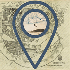
- Create an interactive map of Denmark and the US Virgin Islands, which highlights and investigates the colonial heritage, with a specific focus on the Danish West Indies, as it manifests itself historically and/or presently in these areas.
- Disseminate Europeana API archival material to a wider audience.
- Create a deeper understanding of how the colonial past is still very much present in our contemporary societies and landscapes – and has shaped them.
- Connect archival resources, maps and photographic collections to places of historical interest in order to facilitate a conversation about them between citizens of Denmark, the US Virgin Islands and the rest of the world.
- Develop a dynamic digital platform for the presentation of a hitherto underexposed, perhaps even suppressed, part of Danish cultural heritage.
Phase I
In the first phase of the project we focused on establishing a website prototype that shows the various possibilities for spatial/geographic mapping of history. This has only been possible with the help of a network of professionals, researchers and artists, who have generously contributed valuable material and information about colonial heritage. A special thanks goes to the team behind the Datasprint series at the Royal Library, which formed the basis for this project: namely Mette Kia Krabbe Meyer from the Royal Library and Michael Hockenhull from the IT University of Copenhagen.
Presently, the map features many of the well-known places and prominent historical figures of the colonial era, but as the work continues we would like to see the site expand to include accounts and stories about the lesser-known people of the era. For example, we aim to include a better representation of black West Indian communities living in Copenhagen, as well as more detailed insight into the lives of the enslaved and Free Colored people in the colonies, as well as documenting where slave-owners lived (inspired by this British project: http://www.ucl.ac.uk/lbs/). Another potential for widening the scope is to include significant places and stories from the African coast to visualize the full global scale of the triangular trade.
As of November 2017 we are looking into the possibility of creating an augmented reality app for the second phase of the project.
Background
One of the first things the Danish colonizers did when they came to the West Indies was to document land acquisition in detail through map-making. Obviously, the layout of the land, and their knowledge and control of it, would determine their success in this unknown place. For around almost 250 years Denmark colonized what is now the US Virgin Islands (St. Croix, St. Thomas and St. John), until the territory was sold to the US in 1917.
The Danish West Indies have – as part of the Atlantic slave trade between Denmark, Ghana, and the Virgin Islands – contributed immensely to the growth and prosperity in and around Golden Age Copenhagen. The period is also known in Danish art history as the “Florissant Age:” parts of Copenhagen and numerous estates north of Copenhagen (including Marienborg, the present official residence of the Danish prime minister) were funded by and built on ‘sugar fortunes’, relying primarily on the extensive slave trade and slave economy.
This element of the Danish national consciousness is subdued. Not many think of themselves as citizens of a former colonial power. The Virgin Islands have asked for acknowledgement of this shared history, while some movements on the islands have also asked for a formal apology from the Danish state. Yet, even in the Virgin Islands, knowledge about the Danish past remains inadequate due to several factors, the most important being lack of access to archival material, language barriers and also – in many cases – traumatic suppression.
When the islands were sold to the US in 1917, without a referendum in the Virgin Islands, and the Danish administration left the islands, all official archives, including images, photographs and maps went to Copenhagen, where the documents became part of the National Archives as well as the Image and Maps Collection at the Royal Library. These archives are presently being digitized, and The Royal Library confirms that the Danish-Virgin Islands’ West Indies Archives will be integrated with the European cultural heritage portal Europeana, through European Library, by the beginning of 2017. This project makes use of Europeana Collections while extending the collaborative contributions to include other underrepresented voices. The mapping exercise once practiced to document landownership and Danish colonization is now employed to counteract this same gesture by bringing forward the people, places and stories that have remained hidden or underrepresented. Mapping a Colony addresses this important issue by employing mapping tools and methods from digital humanities.
Illustration: Chaney by La Vaughn Belle, 2014
“Chaney is a colloquialism, a hybrid word combining "china" and "money". It describes shards found in the dirt on many properties and locations throughout the Virgin Islands that often resurface after a hard rainfall. Originally from pieces of colonial fine china imported both in display of and as a result of the wealth of the plantation economy, "chaney" serves as a reminder of both the colonial past and the fragmented present of Caribbean societies. These shards tell the visual stories of power and projection and how cultures reimagine themselves in this vast trans-Atlantic narrative.” ~ http://www.lavaughnbelle.com/#/infinite/

The Team

Lene Asp (LA)
Project manager, journalist and writer

Mace Ojala (MO)
Developer, IT University of Copenhagen

Louise Jørgensen (LJ)
Project manager, cand. mag. from the University of Copenhagen

Nina Sauerland (NS)
Project manager, cand. mag. from the University of Copenhagen
Nanna Bonde Thylstrup (NBT)
Postdoc, University of Copenhagen

Marie Blønd (MB)
ETHOS Lab Manager, IT University of Copenhagen
Contributors

Dr. George Tyson (GT)
Historian

Frandelle Gerard (FG)
Executive director of CHANT, Crucian Heritage and Nature Tourism

Martin Voola (MV)
Co-founder of Another Copenhagen, offering guided city tours of Copenhagen with a focus on the slave trade

Anders Olling (AO)
Co-founder of Another Copenhagen, offering guided city tours of Copenhagen with a focus on the slave trade

Anders Bjørn (AB)

Dr. Jeffrey Perry (JP)
Retired postal worker, educated at Princeton, Harvard, Rutgers and Columbia University. Perry has focused especially on the dissemination of Hubert H. Harrison's literary and intellectual heritage.

La Vaughn Belle (LVB)
Artist, living on St. Croix

Renée Ridgway (RR)
PhD student at Copenhagen Business School and Dutch/American artist
Institutions

